Digital Skipper's Log
The purpose of this site is to offer a free resource for skippers to preserve log data, including images, and see data in a more meaningful way. It is not intended to replace a real log.
Screenshots:

What You Can Add:
- Locations - You can use Google maps (satellite view recommended), to enter an address, search for an address, or manually drop a pin a dot at any location you choose. Locations get converted to latitude and longitude.
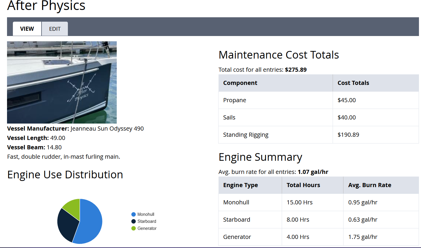
- Vessels - You can enter and manage as many vessels as you like. When you view a vessel you will see all the Maintenance Reports and Log Entries that have referenced that vessel.
- Maintenance Reports - A form that collects relevant information about a maintenance issue and references a Vessel already entered. For this form, if you don't need a field, or it isn't relevant to the entry, just leave it blank.
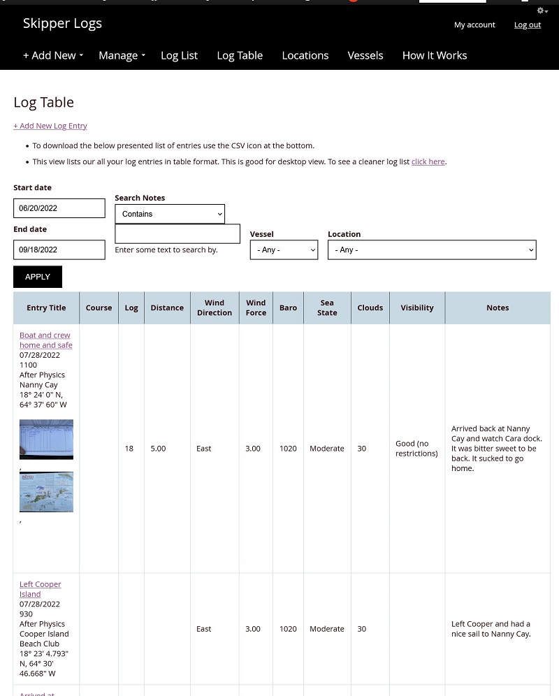
- Log Entries - All the main data points you would find in a Skipper's log book, plus the optional reference to a location and a vessel you have already entered. For this form if you don't need a field, or it isn't relevant to the entry, just leave it blank.
- Images - You can add images to each of the above. Whether it be pictures of real log entries or images of maintenance issues, you can upload a private image to each post type.
Features:
- Data Download - Download your data into a CSV file for use in a spreadsheet.
- Distance aggregation - The distance you enter will aggregate automatically depending on the context. If you want to see all of your entries then the distance traveled equals the total distance traveled. If you are viewing a particular vessel, this page will show you the distance traveled in that vessel over the time period specified.
- Per location data - Each location you add can be referenced from a log entry. After you reference a location, when you visit that location in your Locations Tab you can see all log entries that ever referenced that location. It is a great quick way to see the last time you were there for example.
- Per vessel data - Each vessel will aggregate log entries and maintenance reports that reference it. This is a great way to see snapshot information about maintenance, a list of locations visited and the total distance traveled on that vessel.
- Detailed location gathering - Google Maps API is integrated into the site so the satellite view can be utilized. You can zoom in on hazards, preferred anchor spots, or even a fixed spot on land. Pin dots get converted into latitude and longitude and also collect under your Locations tab so you can see the scope of all your travels.
- Private Image Storage - Your images are only available for viewing through your logged in profile.